A County Boundary Is Not Always a Natural Edge
Learn how to read a county boundary across fields, streets or hills, distinguish its administrative meaning from the landscape, and describe its route accurately.
The most common mistake with a county boundary is to assume it follows the nearest river, ridge or other visible edge. That shortcut can send you searching for a landform that is not there, or make a line across fields look like a mapping error. A county boundary is an administrative division first; the landscape may help explain its course, but it does not have to dictate it.
To read a county boundary accurately, check what kind of map you are looking at, what its line marks and whether scale or boundary history explains an apparent mismatch. Treating every boundary as a natural feature risks giving the map a story it cannot support.
Choose the right map
A line only makes sense in relation to the map’s purpose. A county map may show a ceremonial county, a local-government area, an historic county or a statistical geography. These boundaries can differ even when the labels look familiar.
Check the map title, legend and publication date. Look for wording such as “administrative”, “historic” or “ceremonial”, and note whether the map names a responsible council or mapping authority. If the boundary type is not stated, do not assume that a familiar county name settles the question.
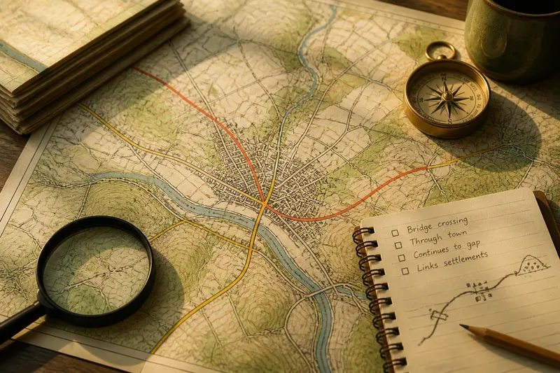
Identify the line symbol, too. A thick line might mark a county boundary; a thinner one nearby could show a district, parish or national park. Colours can help, but printed maps, screen settings and overlapping symbols can make separate lines look like one.
- Check: the legend names the line as a county boundary. If it does, use that classification; if not, look for a source that identifies the boundary type.
- Check: the map gives a date. If it is old, compare it with a current source before describing the present boundary; if no date is visible, avoid claims that depend on currency.
- Check: two maps use the same county definition. If they do, compare their routes; if they do not, explain that they depict different geographies rather than calling one incorrect.
- Check: the boundary symbol is distinct from nearby district, parish or park lines. If it is, trace that symbol; if not, consult a clearer map instead of guessing from colour alone.
- Check: the line remains visible where roads or watercourses cross it. If it does, note the route; if symbols overlap, compare a larger-scale map before claiming an exact position.
- Check: the source identifies an authority responsible for the boundary. If it does, use its mapping for administrative questions; if it does not, treat the map as contextual rather than definitive.
When two maps disagree, they may be answering different questions rather than contradicting each other. Compare their labels and dates before deciding that one is wrong.
Read lines across fields
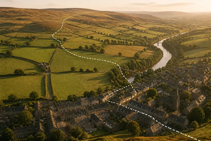
A boundary crossing a pasture, moor or broad valley can look arbitrary. It may run through land with no conspicuous dividing feature, or reflect an administrative decision whose logic is not visible on the ground. A straight or gently bending line does not, by itself, reveal why it was chosen.
Try a larger-scale map. A county overview may simplify bends, omit minor streams or place the boundary close to a field edge for legibility. A detailed map can show whether the line follows a ditch, track, wall or property edge. If it still crosses open ground, treat that as a mapped division rather than inventing an unseen ridge or watercourse.
Say you are tracing a county line across fields on an overview map, where it seems to cut through a farm. You switch to a larger-scale map and see it follow a narrow lane, cross two fields and meet a stream. The resulting interpretation is that the lane and stream accompany parts of the route, while the administrative boundary continues between them; the whole line does not become a natural feature because it follows one in places.
Field boundaries are clues, not proof. Hedges and walls can change, and a boundary drawn close to one may be offset to keep the printed line visible. If the exact position matters, use an authoritative boundary source rather than trying to identify a hedge from a general map.
Separate rivers from boundaries
People often expect a county boundary to follow a river because waterways are easy to see and can separate neighbouring places. But a county line may cross a river, run beside it on one bank, or leave it for higher ground. A river’s presence is evidence about the landscape, not a promise about administration.
Check whether the map shows the river’s centreline, its banks or a simplified blue stroke. On a small map, the boundary and watercourse may appear merged even when they are distinct. Zoom in, compare the symbols and follow each line in both directions. If the boundary departs from the river, record that departure rather than smoothing it away.
Distinguish a river that forms a local boundary from one that merely passes through a county. The same watercourse can divide settlements in one place and run wholly within a single county elsewhere. A map can show where the lines coincide; it cannot, on its own, explain the administrative decision behind that coincidence.
Compare ridges and routes
High ground can make a persuasive natural border. A watershed, escarpment or line of hills may separate drainage and settlement patterns, and a county boundary may follow it for a distance. Yet the administrative line may cross a ridge or take a less obvious route through a pass.
Use contour lines or shaded relief to locate the landform independently of the county line. Closely spaced contours indicate steeper ground; the shape of contours and drainage patterns can help identify a valley or divide. Compare the landform with the boundary without assuming they must align.
It is not worth tracing every contour or hunting for a hidden physical feature whenever the line bends. For a general county map, a clear note that the boundary is administrative is often more accurate than a speculative explanation. Reserve detailed terrain comparison for places where the relationship itself is the question.
Read boundaries in towns
A county line can pass through a built-up area, leaving neighbouring streets, buildings or parts of a settlement on different sides. That may feel counter-intuitive if the town functions as one place, but settlement identity and administrative geography are not the same thing.
First check the scale and boundary type. A small map can make the line appear to run through a street when it actually follows a nearby stream, road centre or property boundary. A detailed administrative map can show the route more clearly, though its line may still be too thick to reveal the exact edge.
Then separate three questions: What is the settlement called? Which county boundary is being shown? Where does that boundary run? A place name or shared service may help describe local identity, but neither establishes which side of an administrative line an address occupies. For an address-level decision, consult the relevant authority’s current map or address service.
Why do county maps differ?
Why do county maps show different lines?
They may depict different county definitions, reflect different publication dates or simplify the boundary at different scales. Check the legend and date on each map before comparing the routes.
Does a county boundary have to follow a river?
No. A boundary can follow a river for part of its route, cross it or remain separate from it. Read the river and boundary as distinct map features unless the source explicitly identifies them as coincident.
How can I tell which county an address is in?
Use a current, authoritative boundary or address resource that identifies the relevant administrative area. A general road atlas or web map may be too small-scale or may show a different county definition.
What if a road or stream hides the boundary?
Compare a larger-scale map and inspect the legend to see which symbol is drawn over the other. If the source does not make the route clear, describe the boundary as approximate rather than claiming a precise position.
Describe the line accurately
State what the map actually supports. “The county line crosses the valley east of the village” is safer than “the valley divides the counties” unless the line clearly follows the valley. If a river, ridge or road runs beside the boundary, say that it accompanies the line for a stretch rather than treating the two as interchangeable.
A useful note can name the boundary type, visible landform and any point where the two part company. For example, record that an administrative line follows a stream near a bridge, then continues across open ground. That wording preserves the geography without turning a partial alignment into a claim about the whole border.
When a county boundary looks awkward, ask what the map says the line represents before trying to explain its route through the landscape. The phrase “county boundary” describes an administrative division; the map’s scale and legend help you read where it runs, while the terrain shows what surrounds it.