The Old Road That Still Shapes a County Map
Learn to spot an old road on a county map by tracing persistent connections, settlement links and landscape clues—not mistaking a straight line for age.
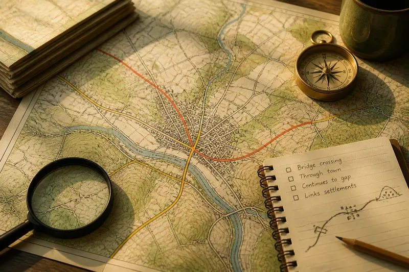
The common mistake when tracing an old road on a county map is treating a straight line as proof of age. That can send you past the more useful clue: a route may bend, split or change name while still linking the same places. Follow the connections it preserves, not just the line it draws.
Road continuity
An old road is not simply one with a weathered surface or a name containing “Old”. For map-reading, the useful idea is continuity of corridor: a route, or a chain of linked routes, that has kept connecting places even as its alignment and status have changed.
A present-day road may occupy only part of an earlier way. It might continue as a narrow lane, a footpath, a farm track or a street through a settlement. A bypass can leave the former approach quiet while its connection remains legible in the local network.
Maps record different moments and purposes. A county road map may emphasise current connections, while an older Ordnance Survey sheet might show a former main road in greater detail. Comparing them can reveal change, but no single map tells the whole story.
Reading the corridor
Look for a sequence of links that makes geographical sense. A route might connect a town to a bridge, pass through a gap between hills and reach another settlement or a junction leading beyond the county. No section has to look remarkable; the repeated connection is what matters.
On paper, use road classifications and settlement patterns as clues, then inspect the same area on a larger-scale map. Digitally, compare the road view with terrain and any available historical layers. Zooming out reveals the broad connection; zooming in can distinguish a continuing lane from a dead end or access road.
Pay attention to how the route enters and leaves places. A road that approaches a town from one direction and continues towards another differs from a short spur serving a single building. Look for aligned streets, a bridge, a junction or a path that carries on beyond the apparent end of the main road.
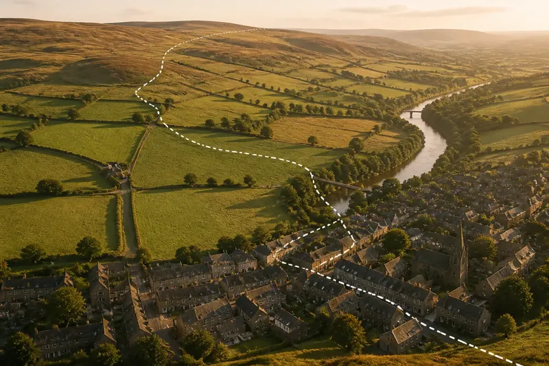
Say you are tracing a route on a county map and see a modern bypass around a market town. You note that a quieter street runs through the centre, connects to the same approach roads on either side and continues towards a bridge and a low gap in nearby hills. The resulting interpretation is a persistent corridor with a changed alignment, not proof of when it began.
Why routes bend
A bend may show adaptation, not poor planning. Roads can follow a manageable slope, avoid wet ground, reach a safe river crossing or join a settlement away from the most direct line. Those adjustments may make a route more useful than a ruler-straight shortcut.
Read bends alongside the land. A contour map can show whether a road climbs gradually, follows a valley side or crosses a ridge at a lower point. A terrain layer helps identify steep slopes and passable gaps. A bend beside a bridge or town entrance may reflect the need to reach a particular place, rather than the terrain alone.
Routes can also shift. A new bridge may draw movement away from a ferry crossing; an improved road may smooth a difficult approach; a bypass may redirect through-traffic while leaving the older street pattern intact. The current line can be the latest version of a longer connection, not the original track preserved in full.
Stronger map clues
Several clues become persuasive when they agree. None settles the question alone, but together they help distinguish a continuing corridor from a line that merely looks tidy on a map.
- Linked destinations: If the route connects several settlements, crossings or regional junctions, treat it as a stronger corridor candidate; if it serves only one isolated site, check for a more local purpose.
- Changes of route type: If a wider road gives way to a lane, path or track that carries on in the same direction, follow that link; if the road stops, check whether another mapped route continues before assuming the corridor ends.
- Settlement alignment: If streets carry the approach through a village or town, count that as continuity; if the road stops at the settlement edge, inspect the other side for a separate connecting street or lane.
- Landscape fit: If the route uses a bridge, valley, pass or manageable slope, consider how that feature explains its course; if it does not, compare nearby crossings and terrain before drawing a conclusion.
- Persistence between maps: If different editions show a recognisable connection despite changes in alignment or classification, record that broad continuity; if they do not, check map dates and legends before treating the difference as a break.
- Junction structure: If branches link the corridor to nearby places, consider its role in a wider network; if the line has no onward links, inspect whether it is simply a local access road.
These clues are more useful than a road name alone. “Old Road” may preserve local memory, but the label does not establish age or former importance. An unremarkable lane can continue a significant connection without any historic name.
When is a straight line misleading?
Straightness may reflect modern design, a survey line or the convenient way a map depicts a route. A straight road can be old, but its shape cannot tell you that. Check what it connects and whether those connections continue beyond the line itself.
A direct road between newer developments may look prominent on a county map yet have no visible continuation through older settlements or across the wider landscape. By contrast, an established route can appear irregular because it threads between steep ground, reaches a river crossing or enters a town through its street network.
Scale can obscure the answer. At a small scale, bends disappear and separate roads may look like one line. At a larger scale, a supposed continuation may prove to be a private access, footpath or road ending at a property. Check the legend and inspect the junctions before deciding.
Choosing maps
Start with a current county or regional road map to see the present network, then use a larger-scale topographic map to inspect lanes, paths, crossings and relief. If a local library or archive has older Ordnance Survey sheets, compare the same area across editions. Look for a continuing connection, not an identical alignment.
Historical map symbols and detail vary. A line might represent a track, turnpike or boundary-side way, depending on the sheet. Read its legend and nearby labels, then compare it with a contemporary map before interpreting the route.
A public footpath map or local authority rights-of-way map may show where a road connection survives as a path. Such maps describe mapped routes and access, not necessarily the full history of a corridor. For further context, consult a local archive or county history resource.
What should you check?
Does it join useful places?
Trace the route in both directions and note its settlements, crossings and junctions. If it links several destinations, treat it as a stronger candidate for a persistent corridor; if it reaches only one site, check whether it is a local spur.
Does it continue across a change of type?
Follow the line where its classification or name changes. If a lane or path carries on in the same general direction, record that connection; if the route ends, inspect nearby junctions before deciding that the wider corridor stops there.
Does the land explain its course?
Compare the route with hills, valleys, rivers and crossing points. If it uses practical gaps or crossings, note that geographical logic; if the terrain offers no clear explanation, compare alternative routes without treating that alone as evidence against continuity.
Do older maps preserve the relationship?
Compare broad connections between editions rather than demanding a matching line. If the alignment shifts but the route still joins the same places, record continuity; if the maps differ sharply, check their dates and legends before interpreting the change.
Keep the search focused
Tracing every curve or collecting every road name is not worth the effort before you understand the larger connection. Nor does a single photograph, label or unusually direct stretch settle a route’s age. Begin with the network and pursue fine detail only when it could change your interpretation.
When tracing an old road on a county map, the useful result is not a date guessed from a line but a clear account of what still connects: the approaches, settlements, crossings and onward routes. If those links survive in altered forms, note where the evidence is firm and where the map leaves room for doubt.